Philadelphia: Workshop of the World
Mapping Philadelphia’s industrial past with digital tools.
Mapping Philadelphia’s industrial past with digital tools.
Two common questions my coworker Phil Bellizzi, the Science History Institute’s public services librarian, is asked during guided tours of our Othmer Library are: “Do you have any materials from local companies?” and “What are some local companies?”
Oh boy, do I have some answers for you!
Much of our modern books and periodicals collection has been built through donations, both from libraries of individuals and from companies or corporations looking to downsize their holdings or close their doors. Most of these donations are from groups local to the Othmer Library, and so they contain materials from Philadelphia-based companies.
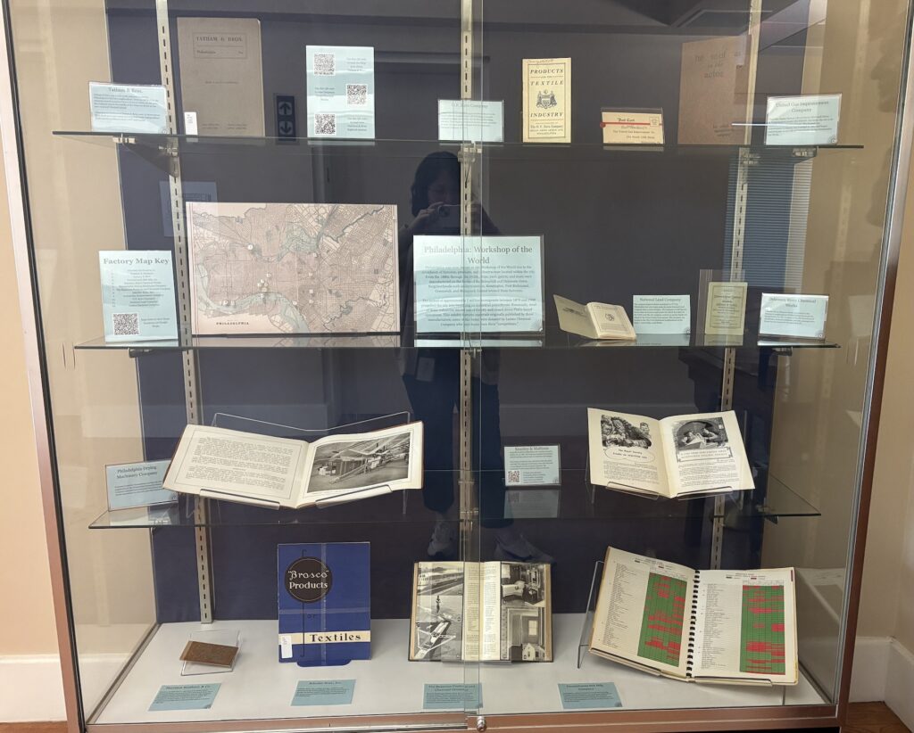
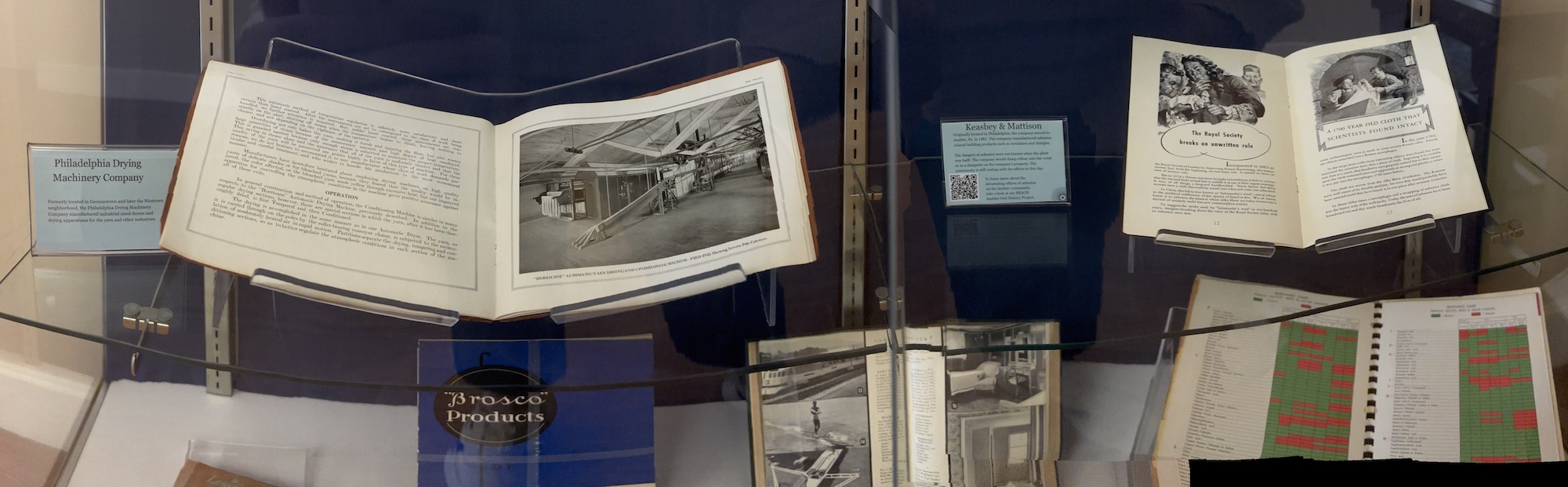
In my last blog post, I wrote about an item that came in from a donation by the shuttered Leatex Chemical Company (located in Philly’s Kensington neighborhood) and how I used digital tools to see where the company that published the booklet would be located today. The questions frequently posed to my colleague combined with my deeply rooted curiosity about Philadelphia’s history led to my creation of a book display in our library’s reading room featuring materials from Philly manufacturers, including a few donated by the Leatex Chemical Company. This rotating book display is a stop on the tours Phil gives.
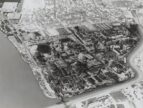
My display highlights a handful of items published by paint, soap, chemical, and other textile manufacturers. But creating a display featuring these companies was not enough to satisfy my curiosity; I also needed to know where the offices and factories were located and what stands on those sites today. Once again, I turned to the digital wonder that is the Greater Philadelphia GeoHistory Network’s interactive map viewer, as well as the Hexamer General Surveys, 1866-1896. Some of the books I chose had the company’s address on the title page or elsewhere in the book; however, for others I had to do some major sleuthing!
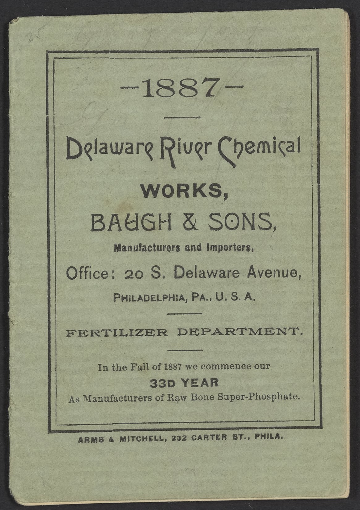
A few of the Philly-based manufacturers included in this display are Delaware River Chemical Works, Pennsylvania Salt Manufacturing Co., Laurel Soap Manufacturing Co., National Lead Company, and Keasbey & Mattison Company.
The Keasbey & Mattison Company, a manufacturer heavily associated with its use of asbestos, was originally located in Philadelphia at 322 Front Street and moved to Ambler, Pennsylvania (a northwest suburb of Philadelphia) in 1881. While the buildings no longer exist, they were located on Spruce Street in Ambler, and the area was later designated an EPA superfund site due to the company’s disposal of asbestos in the nearby Wissahickon Creek. To learn more about the effects of asbestos on the Ambler community, check out our REACH Ambler Oral History collection.
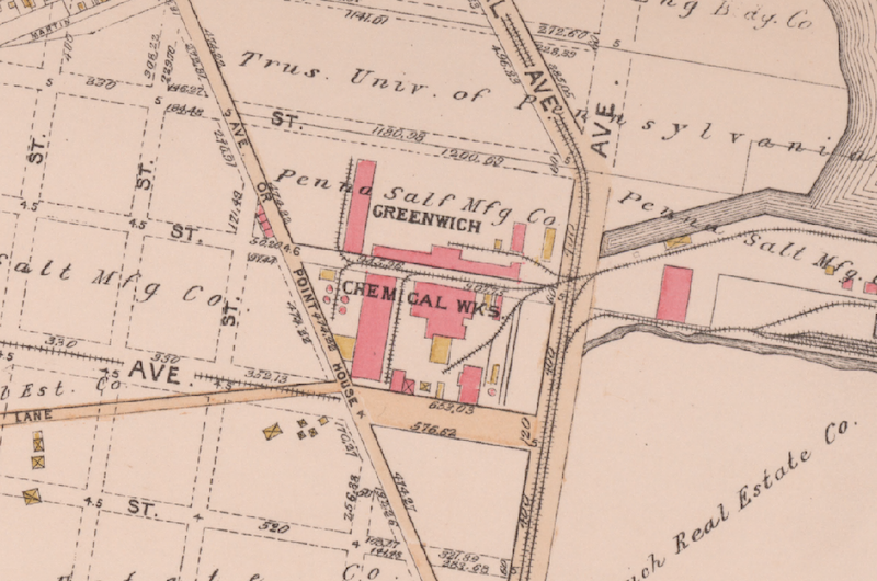
Pennsylvania Salt Manufacturing Co. (Pennsalt), known for its production of caustic soda, soaps, and candles, began in 1850. Reader, are you familiar with the South Philly Ikea? Well, that’s where Pennsalt was located! The neighborhood was called Greenwich after nearby Greenwich Point on the Delaware River. Greenwich was part of a larger neighborhood called “The Neck,” an area akin to a shantytown, which is now located on and around the South Philadelphia Sports Complex. “The Neck” played an important yet not well-known role in Philadelphia’s history.
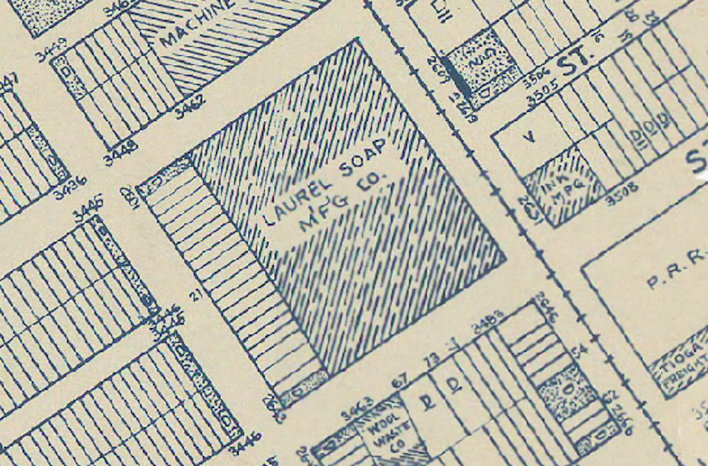
Laurel Soap Manufacturing Company could be found in Port Richmond at 2600 Tioga Street. The company produced soaps, sulphates, and oils, operating sometime between 1900 and 1970. Unfortunately, I could not find much more information about this company. However, the building still stands and you can see a faint ghost sign—a faded, hand-painted advertising sign—on the factory’s façade.
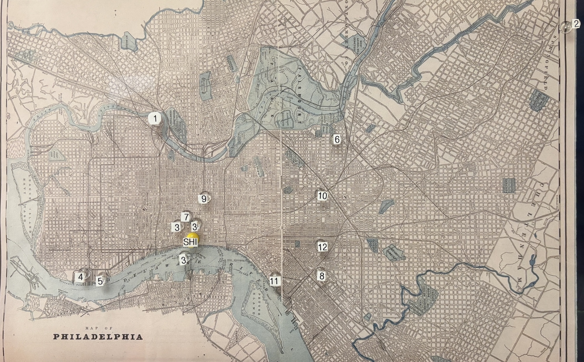
After completing all of my research to discover the locations of these companies’ offices and factories, I compiled the data to make a walking tour in Google Maps. Through Google Maps, you can select the company you would like to view and then zoom in to check out the surrounding neighborhoods and see what’s going on there now. You can also use the GeoHistory interactive map viewer to see other manufacturers that neighbored the ones in the display.
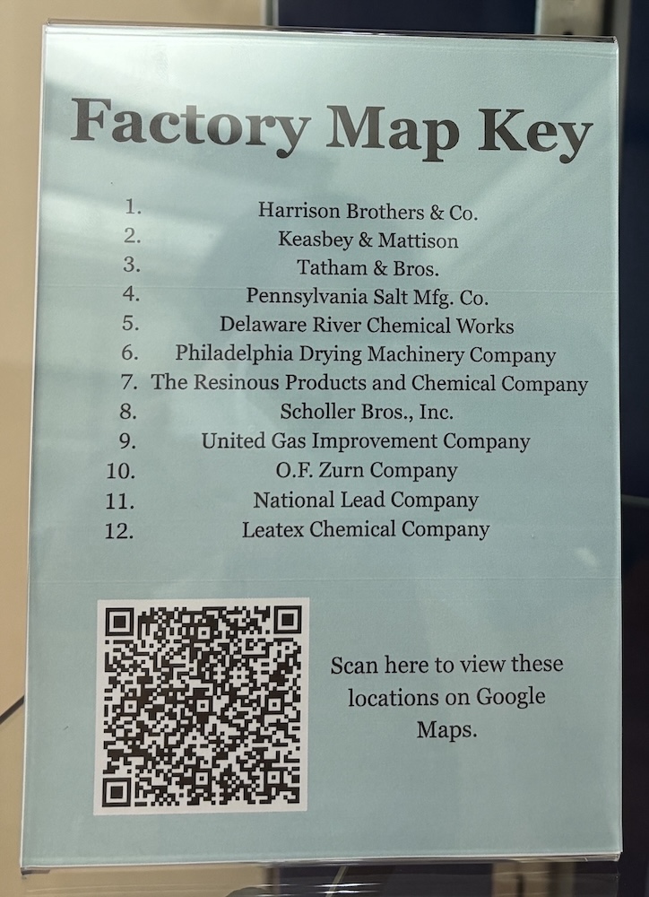
Additionally, I enlarged a map of Philadelphia and stuck push pins in to show the locations of all the companies. There is also a factory map key next to the map so the viewer can reference the companies and locations.
If you didn’t get enough of Philadelphia manufacturers or wish you could view this display in person, you’re in luck! Philadelphia: Workshop of the World is clocking in for a six-month factory shift as part of our A Closer Read exhibition series in the Science History Institute Museum from March through September.
You’re invited to an opening celebration for Workshop of the World on March 13 (rescheduled from March 6), where you can hear me talk about my display while enjoying light refreshments. This event is free, but registration is requested. Hope to see you there!
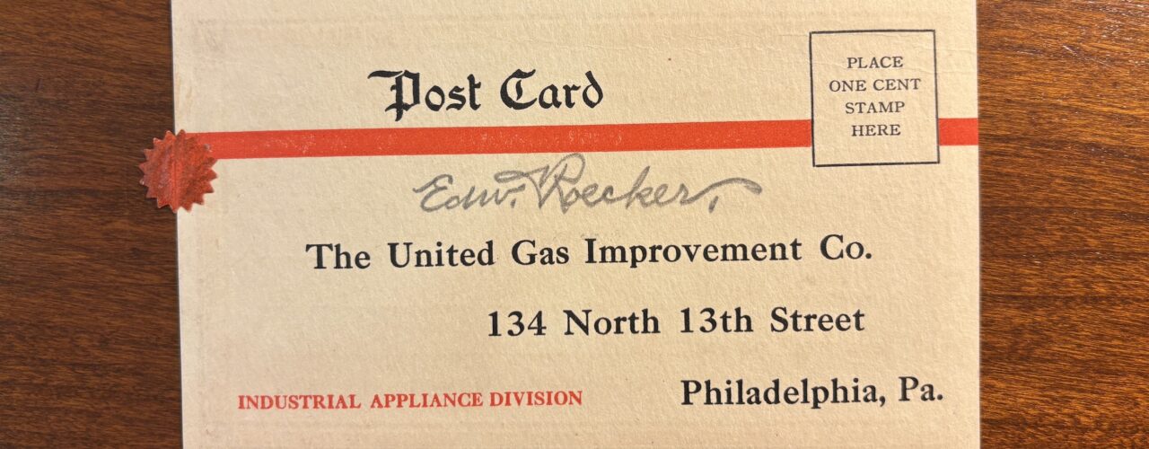
Featured image: Postcard from the industrial appliance division of the United Gas Improvement Co.
Public perceptions of 20th-century medical science as seen through book cover illustrations.

The Institute’s museum education team partners with Philly Touch Tours to offer a more meaningful history of science experience.

Memory, materials, and the history of science in the Eugene Garfield Papers.
Copy the above HTML to republish this content. We have formatted the material to follow our guidelines, which include our credit requirements. Please review our full list of guidelines for more information. By republishing this content, you agree to our republication requirements.